Whitelyne Common Trig Point
Trig Point In Kielder, Northumberland
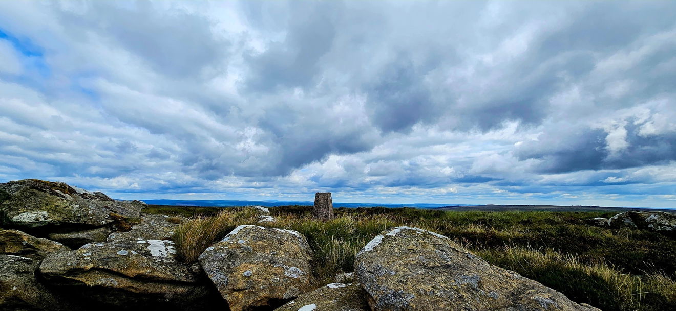
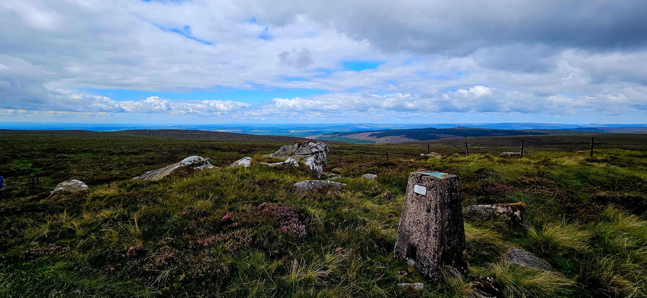
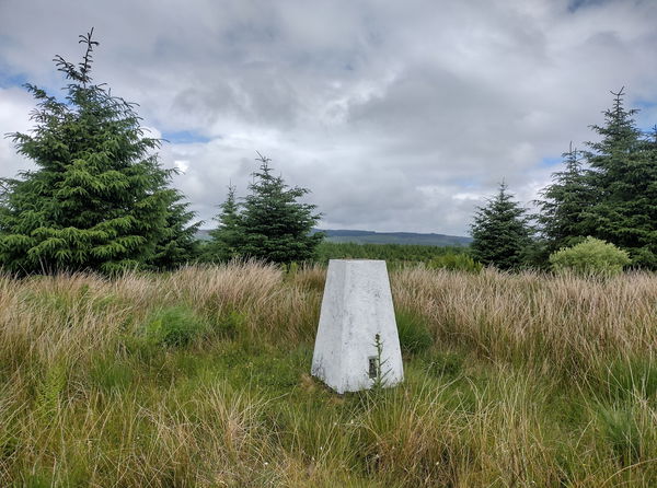
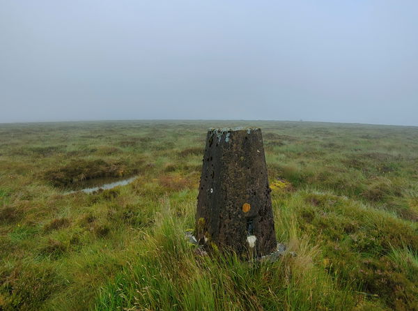
This is the trig point for Whitelyne Common (519m) near Kielder.
Height - 519m// Bracket - 10862 // Postcode - NE48 1BS
Login to be able to bag trig point and see which trig points are left on your to do list.
Login To Bag Trig PointsThis is the Whitelyne Common trig point (519m) in on Sighty Crag, Whitelyne Common near Kielder.
From the parking, pick up the permissive path NE and follow this into the forest, keeping to the path all the way. This will then drop you out at Round Crag where you can follow a quad bike track to the fence.
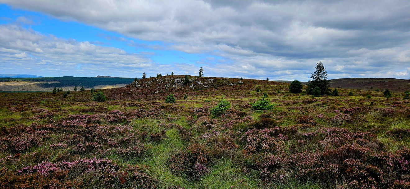
From here start heading north hugging the fence line all the way to Sighty Crag and the trig point.
Just follow this map, or find it on OS Maps. It's 6km and 324m of ascent, so get your hiking boots on.
Thanks to Nicola Tilt for all the photos and information for this one.
Login to be able to bag trigs and see which trigs are left on your to do list.
Login To Bag Trig PointsHow To Find Whitelyne Common Trig Point
Where Is Whitelyne Common Trig Point?
Lat / Long
55.121079, -2.6265422
What three words
Where To Park For Whitelyne Common Trig Point?
Lat / Long
55.097739, -2.692567
What three words
Park up off the main track.
More Trig Points Near Kielder
Find more trig points near to Kielder, Northumberland.
Cairnglastenhope Trig Point
312m Bracket S6585 KielderThis is the trig point for Cairnglastenhope (315m) near Kielder.
Little Hen Hill Trig Point
344m Bracket S6492 KielderThe Little Hen Hill trig point sits in a forest (344m) near Kielder.
Glendhu Hill Trig Point
514m Bracket S7998 KielderThis is the trig point for Glendhu Hill (514m) near Kielder.

Find Us On Facebook
Come and join our friendly Facebook group and share photos of your trig bagging.
Or ask any questions about the trig points in Northumberland.
Join Northumberland Trigs Facebook Group