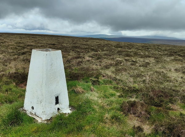
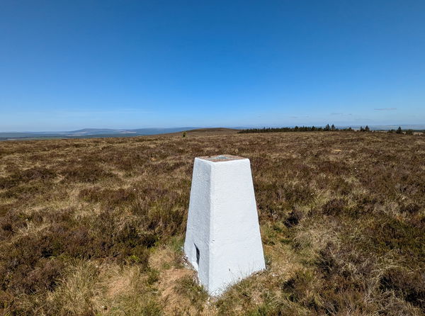
Glendhu Hill Trig Point
Trig Point In Kielder, Northumberland
This is the trig point for Glendhu Hill (514m) near Kielder.
Height - 514m// Bracket - S7998 // Postcode - NULL
Login to be able to bag trig point and see which trig points are left on your to do list.
Login To Bag Trig Points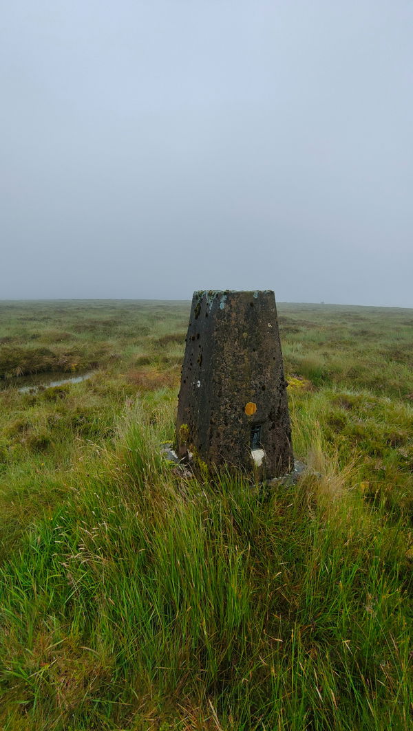
This is the Glendhu Hill trig point (514m) in Kershope Forest in Northumberland.

Strap your hiking boots on for this one is a cracking meander to the top of Glendhu Hill.
From the parking just over the border at Kershope Bridge you're going to be heading east through Kershope Forest for most of the way with a final trek across the moors.
Just follow this route to the Glendhu Hill trig point, or find it on OS Maps. This one is over 10km to get there and 412m of ascent!
Thanks to Michael Alexander for the information and photographs.
Login to be able to bag trigs and see which trigs are left on your to do list.
Login To Bag Trig PointsHow To Find Glendhu Hill Trig Point
Where Is Glendhu Hill Trig Point?
Lat / Long
55.169796, -2.6795366
What three words
Where To Park For Glendhu Hill Trig Point?
Lat / Long
55.142478, -2.785131
What three words
There is a little parking area at Kershopehead right on the border.
More Trig Points Near Kielder
Find more trig points near to Kielder, Northumberland.
White Crags Trig Point
537m Bracket S7503 KielderThis is the trig point for White Crags (537m) near Kielder.

The Grun Trig Point
516m Bracket S7909 KielderThis is the trig point for The Grun (516m) near Kielder.
Black Knowe Trig Point
493m Bracket S7430 KielderThis is the trig point for Black Knowe (493m) near Kielder.
Find Us On Facebook
Come and join our friendly Facebook group and share photos of your trig bagging.
Or ask any questions about the trig points in Northumberland.
Join Northumberland Trigs Facebook Group